SkyRun 2026
SkyRun 2026: self-navigated mountain ultra trail from 38km to 100km in South Africa's Witteberg range. 4,500m D+, since 1996. ITRA certified.
Information
Contact
Social networks
Formats
Practical information
Description
South Africa's Iconic Mountain Ultra
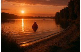
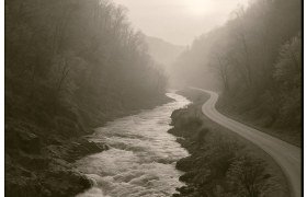
SkyRun is South Africa's oldest and most iconic mountain ultra-trail race, held annually since 1996 in the remote Witteberg mountain range of the Eastern Cape. Over 30 years of history, SkyRun has earned a legendary reputation as one of the toughest self-navigated, self-supported mountain races on the African continent.
The race follows a point-to-point route from Lady Grey to Wartrail, crossing the wild and rugged Witteberg range at altitudes reaching 2,756 metres at Avoca Peak. What sets SkyRun apart from most trail races is its emphasis on self-navigation — there are no course markings, and runners must navigate using maps, compass, and GPS through remote mountain terrain. This adds a significant strategic dimension to an already formidable physical challenge.
Sponsored by K-Way, SkyRun is registered with ITRA and has become a rite of passage for serious South African mountain runners. The event's motto, "Running at altitude without attitude", captures its unpretentious, adventure-first ethos.
Courses and Formats
SkyRun 100 km (4,500m D+)
The flagship 100-kilometre course is the ultimate test of mountain endurance and navigation. Starting at 04:00 in the dark, runners traverse the full Witteberg range with 4,500 metres of elevation gain across 11 checkpoints. The 30-hour time limit means mandatory night running through remote mountain terrain. Iconic features include the Dragonback — a narrow 3-metre-wide ridgeline with steep drops on either side — and Balloch Wall, a brutal climb with over 500 metres of vertical gain in just 3 kilometres.
SkyRun 65 km (3,000m D+)
The 65-kilometre distance offers a substantial mountain ultra experience with over 3,000 metres of climbing and 8 checkpoints. Also starting at 04:00 with a 20-hour cutoff, this route covers the most dramatic sections of the Witteberg range while being marginally more accessible than the full 100 km.
SkyRun 38 km (1,800m D+)
Starting at 14:00 in the afternoon, the 38-kilometre format provides an intense mountain trail experience with 1,800 metres of elevation gain and 4 checkpoints. The afternoon start means runners will face nightfall on the mountain, adding to the adventure. The 20-hour cutoff gives ample time for those new to mountain ultras.
Terrain and Difficulty
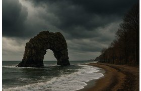
The Witteberg terrain is wild, remote and unforgiving. Runners cross exposed ridgelines, rocky mountain passes, grassy plateaux and steep river valleys. The altitude — consistently above 2,000 metres with peaks approaching 2,800 metres — adds physiological stress, particularly for runners from coastal cities. Temperatures can swing dramatically, from hot daytime conditions to near-freezing nights at altitude.
The self-navigation requirement elevates the difficulty significantly. In poor visibility (fog, rain, darkness), route-finding across the featureless mountain plateaux demands strong navigational skills. Getting lost is a real possibility and can add hours and considerable distance to the race.
History and Heritage
Founded in 1996, SkyRun is one of the oldest mountain ultra races in Africa. Over three decades, it has maintained its core identity as a self-navigated wilderness challenge, resisting the trend toward marked, supported trail races. The event has become a bucket-list race for South African trail runners and has inspired a generation of mountain athletes in the country.
Practical Information
- Self-navigation: no course markings — runners must carry and use maps, compass, and/or GPS device
- Self-supported: limited aid at checkpoints — runners must carry sufficient food and water between stations
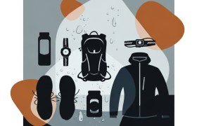
- Mandatory equipment: comprehensive kit list including navigation tools, warm clothing, waterproof layers, headlamp with spare batteries, emergency blanket
- Night running: all distances involve running in darkness — reliable headlamp essential
- Getting there: Lady Grey is in the Eastern Cape, approximately 5 hours from Bloemfontein and 7 hours from Johannesburg
Is the SkyRun course marked?
No. SkyRun is a self-navigated race with no course markings. Runners must navigate using maps, compass, and GPS. This is a fundamental part of the SkyRun experience and adds a significant strategic element. Strong navigation skills are essential, especially in poor visibility conditions common at altitude in the Witteberg range.
What altitude does the SkyRun reach?
The highest point on the course is Avoca Peak at 2,756 metres. The majority of the 100 km course runs above 2,000 metres. Runners from low-altitude areas should consider arriving early to acclimatise, as altitude effects can significantly impact performance.
How difficult is the SkyRun compared to other South African ultras?
SkyRun is widely considered one of the toughest trail races in South Africa. The combination of self-navigation, remote terrain, high altitude, extreme weather variability and technical features like the Dragonback ridge and Balloch Wall make it exceptionally demanding. The 100 km has a historically high attrition rate.
Share it with one of your triathlete friends. 🙏
Similar events
Discover other Trail events in the same region
Other Suggestions
- 15/08 Whale of Trail
- 05/09 Table Mountain Challenge
- 05/09 Hout Bay Trail Challenge
- 23/09 Otter African Trail Run
- 19/10 Ultra X South Africa